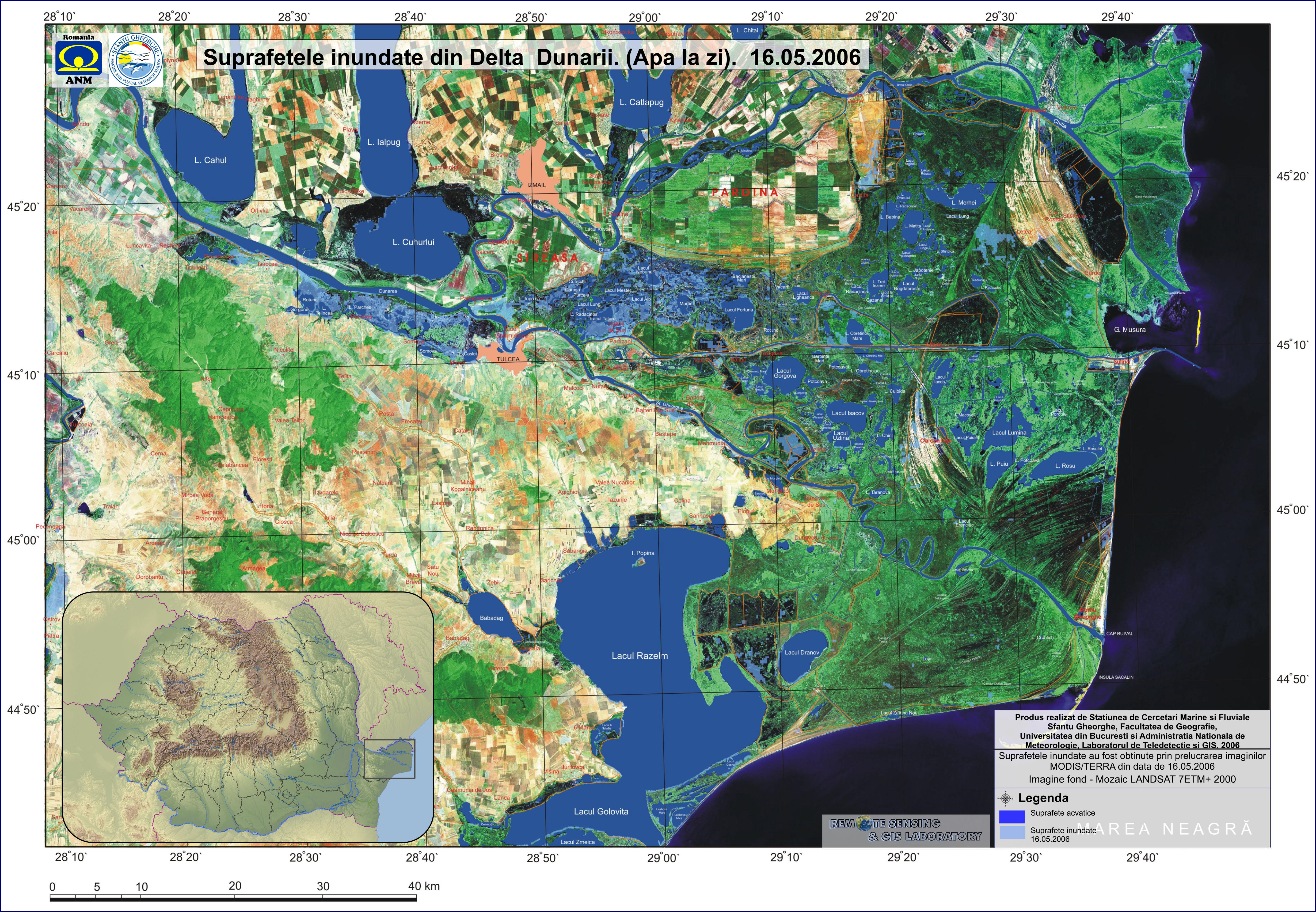
| 16.05.2006 |

|
Title: Floded areas in the Danube Delta |
|
Authors: Sfantu Gheorghe Marine and Fluvial Research Station - Faculty of Geography - University of Bucharest and NMA - Remote Sensing & GIS Laboratory |
|
Type: Poster |
|
Reference data: LANDSAT ETM+ 2000 + GIS layers |
|
Flood mask: MODIS/TERRA from 16.05.2006, hour 09:00 UTC, 11:00 local |
|
Framework: Project NATO SfP 978016 |
|
Download product: 15% (1.2 MB - low resolution) | 50% (5.6 MB - medium resolution) | 100% (14 MB - high_resolution)
|
|
Download raw data:
|
|
Observations: The 100% version of the map is optimized for A1 printing. |
| 13.05.2006 |

|
Title: Floded areas in the Danube Delta |
|
Authors: Sfantu Gheorghe Marine and Fluvial Research Station - Faculty of Geography - University of Bucharest and NMA - Remote Sensing & GIS Laboratory |
|
Type: Poster |
|
Reference data: LANDSAT ETM+ 2000 + GIS layers |
|
Flood mask: MODIS/TERRA from 13.05.2006, hour 08:45 UTC, 10:45 local |
|
Framework: Project NATO SfP 978016 |
|
Download product: 15% (1.2 MB - low resolution) | 50% (5.6 MB - medium resolution) | 100% (14 MB - high_resolution)
|
|
Download raw data:
|
|
Observations: The 100% version of the map is optimized for A1 printing. |
| 10.05.2006 |

|
Title: Floded areas in the Danube Delta |
|
Authors: Sfantu Gheorghe Marine and Fluvial Research Station - Faculty of Geography - University of Bucharest and NMA - Remote Sensing & GIS Laboratory |
|
Type: Poster |
|
Reference data: LANDSAT ETM+ 2000 + GIS layers |
|
Flood mask: MODIS/TERRA from 10.05.2006, hour 09:40 UTC, 11:40 local |
|
Framework: Project NATO SfP 978016 |
|
Download product: 15% (1.2 MB - low resolution) | 50% (5.6 MB - medium resolution) | 100% (14 MB - high_resolution)
|
|
Download raw data:
|
|
Observations: The 100% version of the map is optimized for A1 printing. |
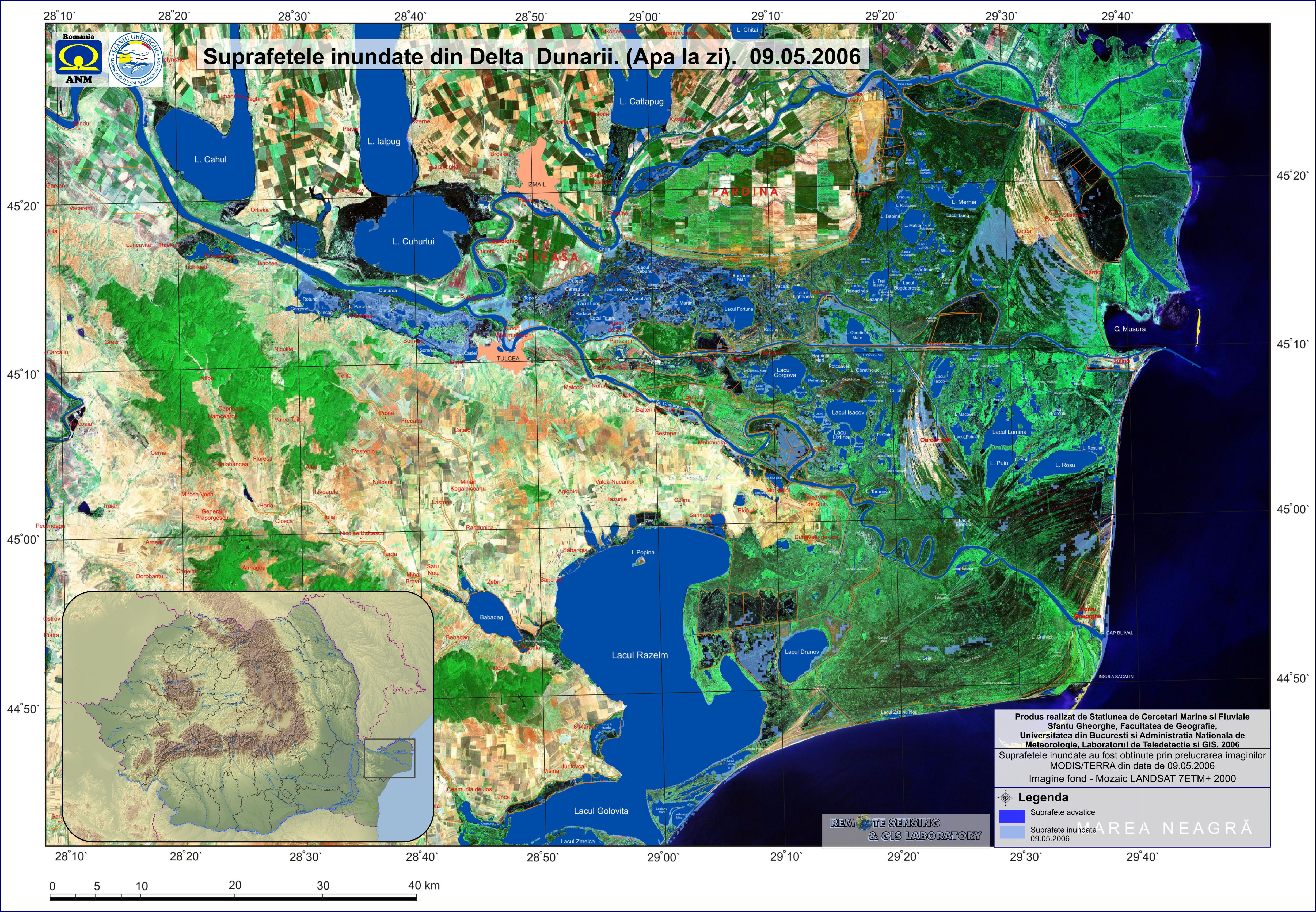
| 09.05.2006 |

|
Title: Floded areas in the Danube Delta |
|
Authors: Sfantu Gheorghe Marine and Fluvial Research Station - Faculty of Geography - University of Bucharest and NMA - Remote Sensing & GIS Laboratory |
|
Type: Poster |
|
Reference data: LANDSAT ETM+ 2000 + GIS layers |
|
Flood mask: MODIS/TERRA from 09.05.2006, hour 08:55 UTC, 10:55 local |
|
Framework: Project NATO SfP 978016 |
|
Download product: 15% (1.2 MB - low resolution) | 50% (5.6 MB - medium resolution) | 100% (14 MB - high_resolution)
|
|
Download raw data:
|
|
Observations: The 100% version of the map is optimized for A1 printing. |
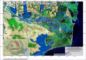
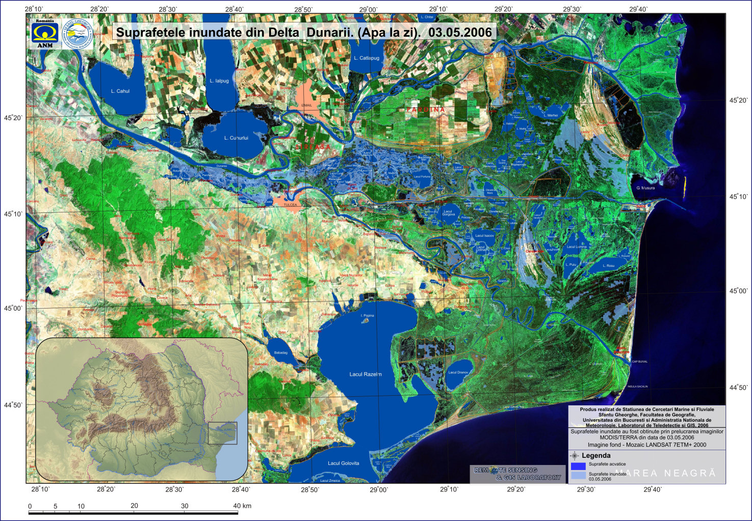
| 03.05.2006 |
|
Title: Floded areas in the Danube Delta |
|
Authors: Sfantu Gheorghe Marine and Fluvial Research Station - Faculty of Geography - University of Bucharest and NMA - Remote Sensing & GIS Laboratory |
|
Type: Poster |
|
Reference data: LANDSAT ETM+ 2000 + GIS layers |
|
Flood mask: MODIS/TERRA from 03.05.2006, hour 09:30 UTC, 11:30 local |
|
Framework: Project NATO SfP 978016 |
|
Download product: 15% (1.2 MB - low resolution) | 50% (5.6 MB - medium resolution) | 100% (14 MB - high_resolution)
|
|
Download raw data:
|
|
Observations: The 100% version of the map is optimized for A1 printing. |
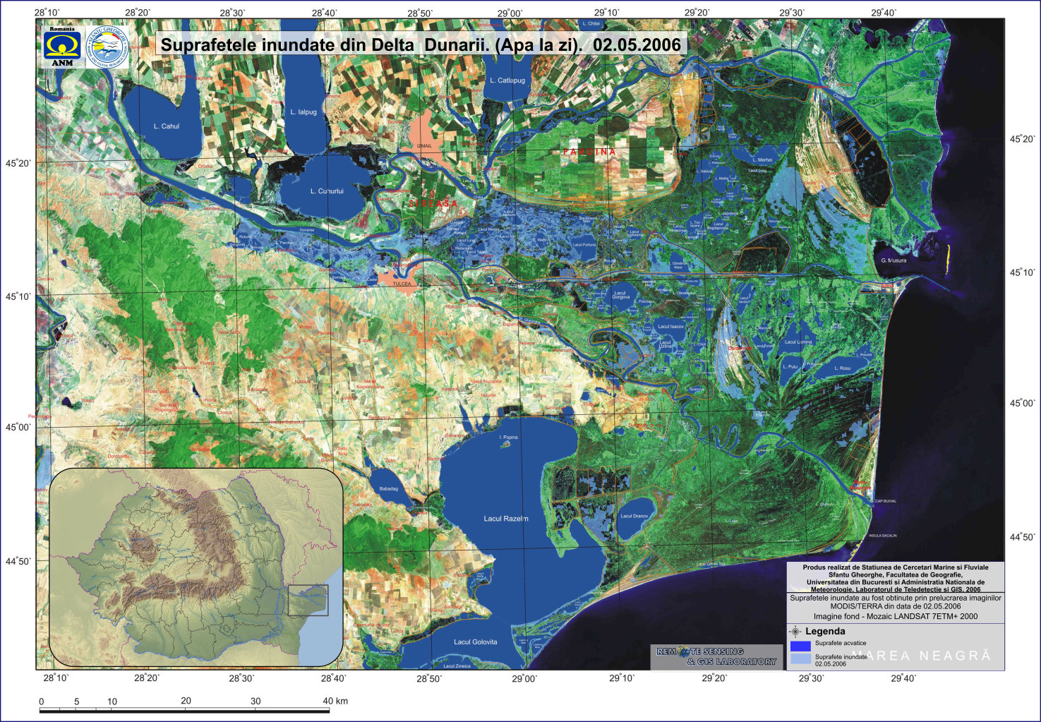
| 02.05.2006 |

|
Title: Floded areas in the Danube Delta |
|
Authors: Sfantu Gheorghe Marine and Fluvial Research Station - Faculty of Geography - University of Bucharest and NMA - Remote Sensing & GIS Laboratory |
|
Type: Poster |
|
Reference data: LANDSAT ETM+ 2000 + GIS layers |
|
Flood mask: MODIS/TERRA from 02.05.2006, hour 08:45 UTC, 10:45 local |
|
Framework: Project NATO SfP 978016 |
|
Download product: 15% (1.2 MB - low resolution) | 50% (5.6 MB - medium resolution) | 100% (14 MB - high_resolution)
|
|
Download raw data:
|
|
Observations: The 100% version of the map is optimized for A1 printing. |
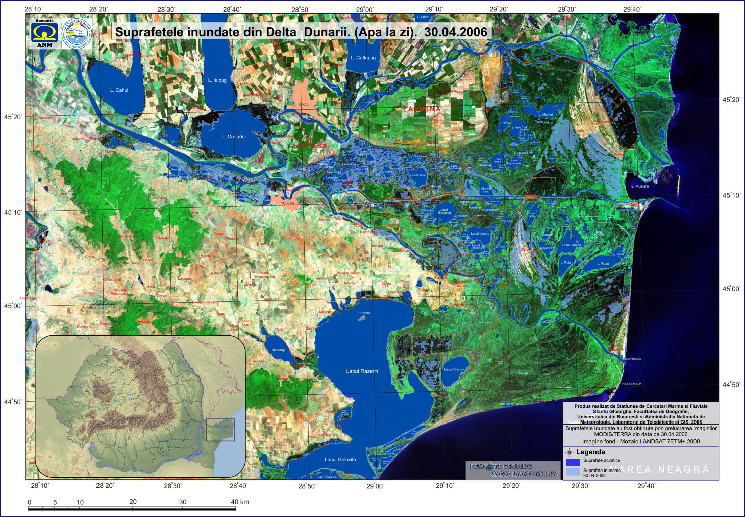
| 30.04.2006 |

|
Title: Floded areas in the Danube Delta |
|
Authors: Sfantu Gheorghe Marine and Fluvial Research Station - Faculty of Geography - University of Bucharest and NMA - Remote Sensing & GIS Laboratory |
|
Type: Poster |
|
Reference data: LANDSAT ETM+ 2000 + GIS layers |
|
Flood mask: MODIS/TERRA from 30.04.2006, hour 10:30 UTC, 12:30 local |
|
Framework: Project NATO SfP 978016 |
|
Download product: 15% (1.2 MB - low resolution) | 50% (5.6 MB - medium resolution) | 100% (14 MB - high_resolution)
|
|
Download raw data:
|
|
Observations: The 100% version of the map is optimized for A1 printing. |
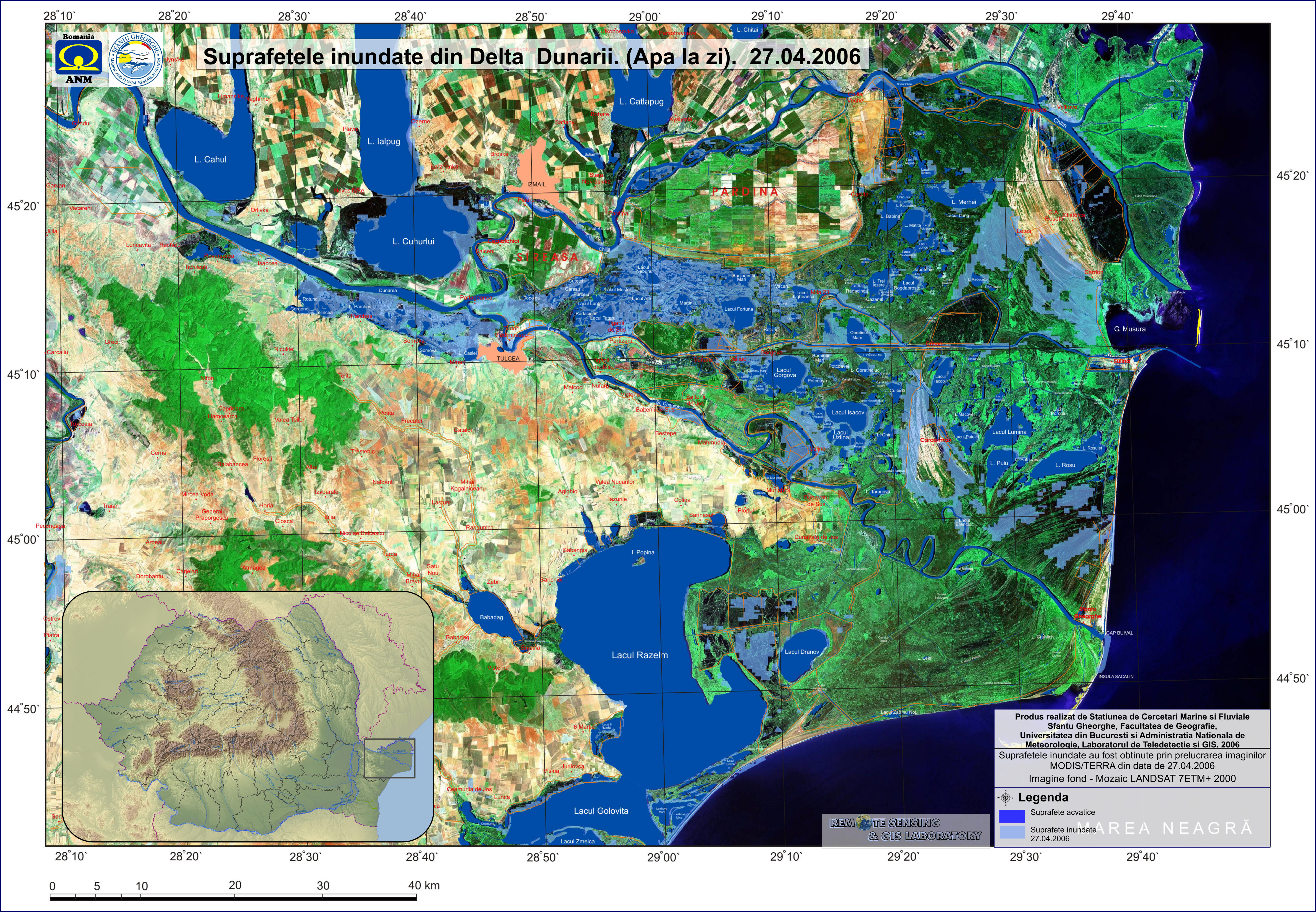
| 27.04.2006 |

|
Title: Floded areas in the Danube Delta |
|
Authors: Sfantu Gheorghe Marine and Fluvial Research Station - Faculty of Geography - University of Bucharest and NMA - Remote Sensing & GIS Laboratory |
|
Type: Poster |
|
Reference data: LANDSAT ETM+ 2000 + GIS layers |
|
Flood mask: MODIS/TERRA from 27.04.2006, hour 09:25 UTC, 11:25 local |
|
Framework: Project NATO SfP 978016 |
|
Download product: 15% (1.2 MB - low resolution) | 50% (5.6 MB - medium resolution) | 100% (14 MB - high_resolution)
|
|
Download raw data:
|
|
Observations: The 100% version of the map is optimized for A1 printing. |
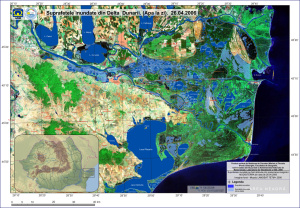
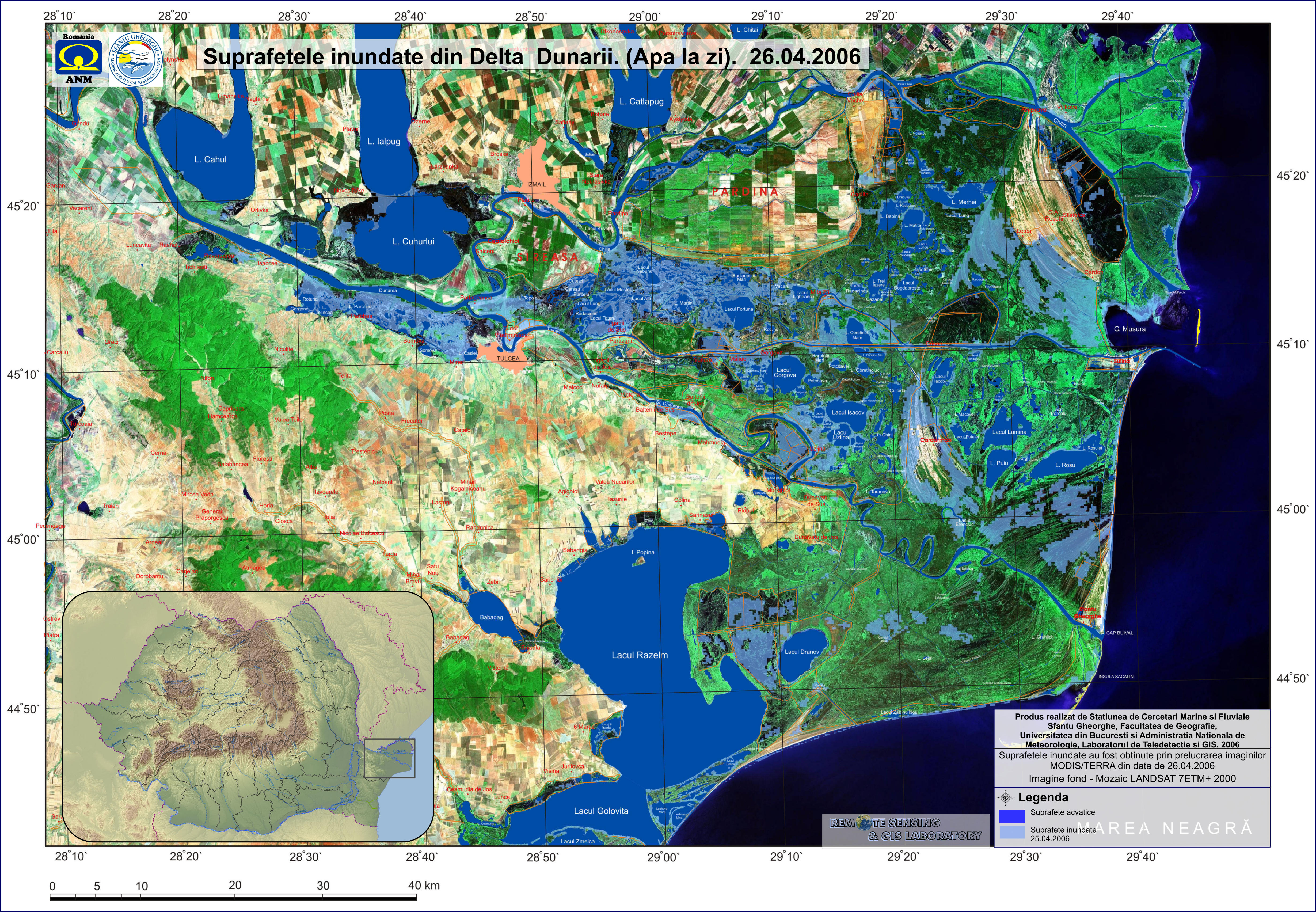
| 26.04.2006 |
|
Title: Floded areas in the Danube Delta |
|
Authors: Sfantu Gheorghe Marine and Fluvial Research Station - Faculty of Geography - University of Bucharest and NMA - Remote Sensing & GIS Laboratory |
|
Type: Poster |
|
Reference data: LANDSAT ETM+ 2000 + GIS layers |
|
Flood mask: MODIS/TERRA from 26.04.2006, hour 09:25 UTC, 11:25 local |
|
Framework: Project NATO SfP 978016 |
|
Download product: 15% (1.2 MB - low resolution) | 50% (5.6 MB - medium resolution) | 100% (14 MB - high_resolution)
|
|
Download raw data:
|
|
Observations: The 100% version of the map is optimized for A1 printing. |
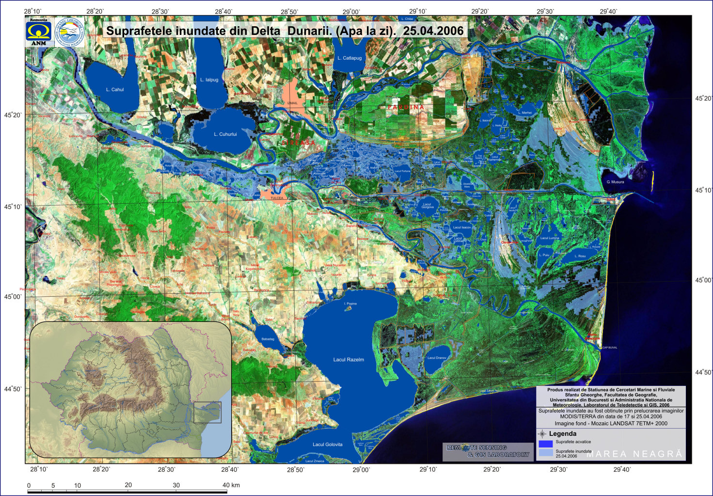
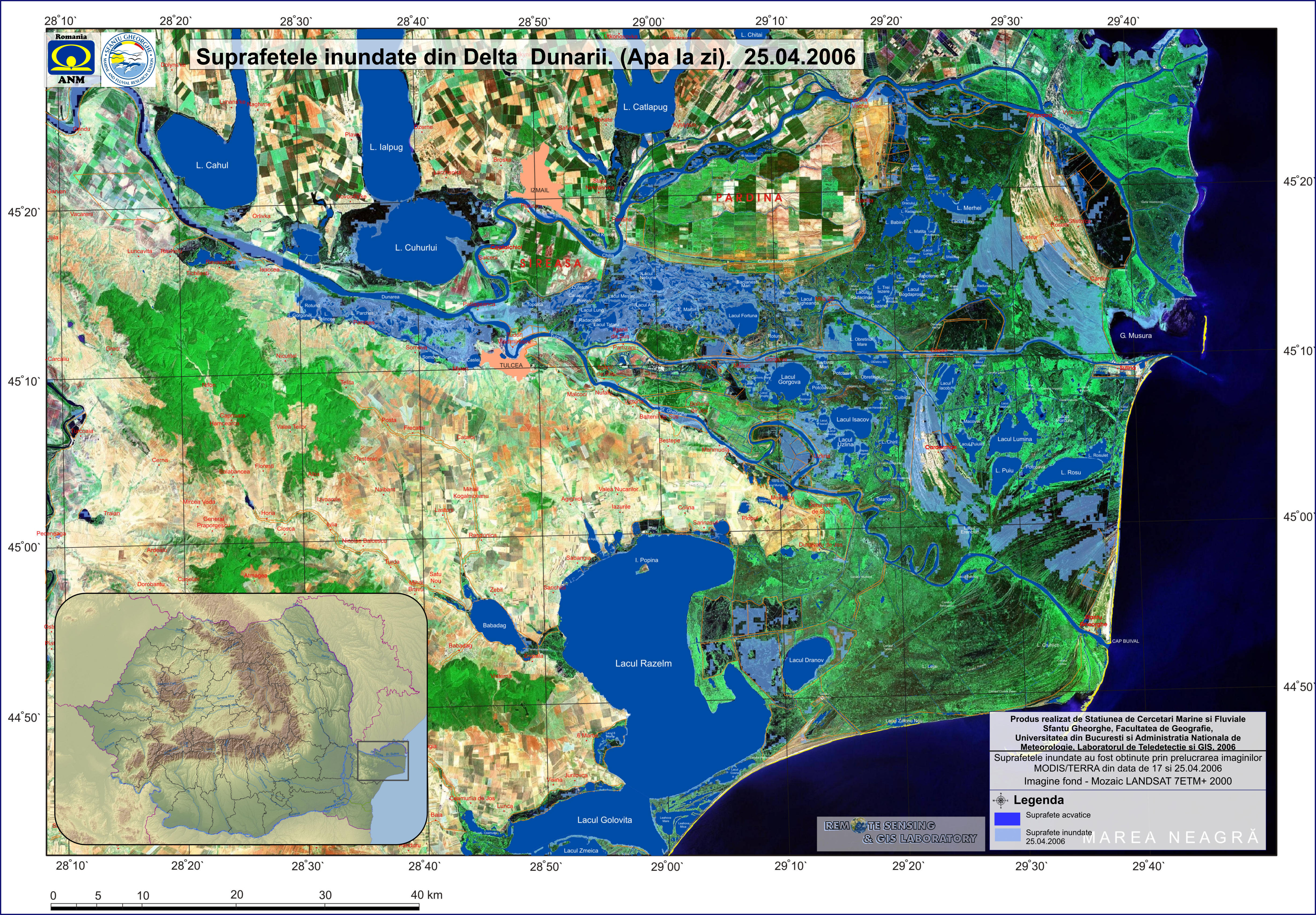
| 25.04.2006 |

|
Title: Floded areas in the Danube Delta |
|
Authors: Sfantu Gheorghe Marine and Fluvial Research Station - Faculty of Geography - University of Bucharest and NMA - Remote Sensing & GIS Laboratory |
|
Type: Poster |
|
Reference data: LANDSAT ETM+ 2000 + GIS layers |
|
Flood mask: MODIS/TERRA from 25.04.2006, hour 08:40 UTC, 10:40 local |
|
Framework: Project NATO SfP 978016 |
|
Download product: 15% (1.2 MB - low resolution) | 50% (5.6 MB - medium resolution) | 100% (14 MB - high_resolution)
|
|
Download raw data:
|
|
Observations: The 100% version of the map is optimized for A1 printing. |
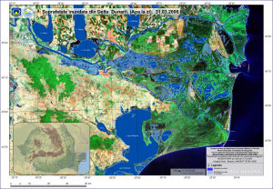
| 31.03.2006 |
|
Title: Floded areas in the Danube Delta |
|
Authors: Sfantu Gheorghe Marine and Fluvial Research Station - Faculty of Geography - University of Bucharest and NMA - Remote Sensing & GIS Laboratory |
|
Type: Poster |
|
Reference data: LANDSAT ETM+ 2000 + GIS layers |
|
Flood mask: MODIS/TERRA from 31.03.2006, hour 08:45 UTC, 10:45 local |
|
Framework: Project NATO SfP 978016 |
|
Download product: 15% (1.2 MB - low resolution) | 50% (5.6 MB - medium resolution) | 100% (14 MB - high_resolution)
|
|
Download raw data:
|
|
Observations: The 100% version of the map is optimized for A1 printing. |